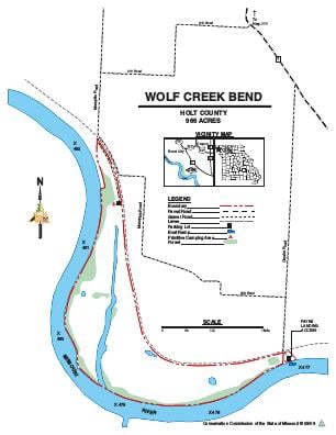
Driving DirectionsFrom Oregon, take Highway 111 west 2.25 miles, then Route T south 2.50 miles, and 310 west 2.50 miles and Memphis Road south. Area is also accessible by foot from Payne Landing.
HighlightsWolf Creek Bend is a mix of cropland and idle cropland with some small tracts of timber along the Missouri River.
About This AreaThe United States Army Corps of Engineers has purchased this area as part of the Missouri River Mitigation Project. The mitigation project has been designed to enhance fish and wildlife habitat along the Missouri River. The area is managed through a cooperative effort between the Corps of Engineers and the Missouri Department of Conservation.This area is managed for a wide variety of game and non-game fish and wildlife species. Rich bottomland soils here produce a wide variety of wetland vegetation and bottomland timber, which are supplemented by plantings of warm-season grasses. management practices include reforestation, prescribed burning, and opportunistic wetland management.