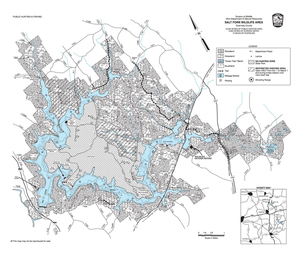
Situated in the hills of southeastern Ohio, the Salt Fork Wildlife Area and the Salt Fork State Park have a steep to rolling terrain that is dissected by numerous small streams. The largest of these, Salt Fork Creek, has been impounded to create the 2,952-acre Salt Fork Lake. The area is administered by the Division of Wildlife and the Division of Parks and Recreation, respectively, of the Ohio Department of Natural Resources. The Division of Wildlife is responsible for fish and wildlife management and public hunting and fishing activities on the area. The Division of Parks and Recreation is responsible for development and maintenance of the general recreational facilities of the park area. The main entrance to this 20,542-acre recreation area is seven miles east of Cambridge on U.S. Route 22.
Lying to the east of Salt Fork Lake, the wildlife area is deeply dissected by the stream and tributaries which flow into the lake. Elevations vary from 1,065 to 790 feet above mean sea level. Thirty-five percent of the wildlife area is woods, mostly on the steeper slopes and along the streams. Oak and hickory dominate the drier slopes; maple, beech, elm, ash, willow, and sycamore are more common on the lower slopes and bottom lands.Cropfields, former cropfields, and old pasture dominated by grasses and other herbaceous plants occupy one-third of the wildlife area. A variety of shrubs and small trees, such as dogwood and sassafras, intermixed with grasses and other perennials, are dominant on the remaining 28 percent of the wildlife area.