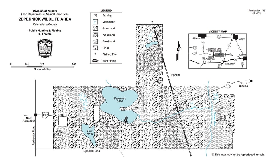
This 518-acre wildlife area lies four miles northwest of Hanoverton in western Columbiana County. Access is provided from State Route 172, which bisects the area.
The area lies in the glaciated plateau region of northeastern Ohio. The terrain is gently rolling to steep, with a few poorly drained glacial pothole areas. Elevations vary from 1,140 feet to slightly over 1,340 feet above mean sea level. The area contains one 39-acre lake; two ponds, one and seven acres in size; and one five-acre man-made marsh. Open fields and brushland comprise the largest portion of the area, with approximately 35 percent being cultivated. Second growth hardwoods occupy 25 percent of the area. Ash, tulip, red maple, cherry, oak, hickory, beech, and sugar maple make up most of the woodland acreage.