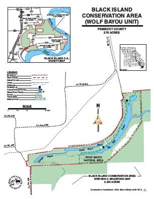
Driving DirectionsTake the Wardell exit off I-55 and follow the east outer road south to Route BB, then take Route BB over the levee until it ends.
HighlightsThis area contains bottomland forest. Facilities/features: boat ramp, Wolf Bayou (43 fishable acres), and Wolf Bayou Natural Area.
About This AreaWolf Bayou contains 263 acres, of which 220 are forest. The area was purchased with Conservation Department funds between 1971-73. Eight acres are leased from the St. Francis Levee District under a 30-year arrangement.Wolf Bayou is one of the state's last natural lowland lakes. The area provides opportunities for outdoor recreation and is managed to maintain unique forest cover and aquatic resources. Forest cover in the Bootheel region is less than two percent of the land area. The forest is a remnant of the once extensive bottomland hardwood forest that covered more than two million acres of the Missouri Bootheel.The area has four bayous totaling 43 acres of surface water. While there is little doubt the bayous are river formed, their exact origin is unclear. The deep, steep-sided , linear bayous have both washout and oxbow characteristics.Wolf Bayou itself is a designated natural area.