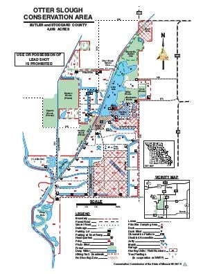
Driving DirectionsFrom Dexter, take Highway 60 west, then Route ZZ south 10 miles, then County Road 675 west 2 miles to the area entrance.
HighlightsThis area contains 2,600 acres of wetlands as well as cropland, forest and old fields. Facilities/features: a concrete boat ramp, 21 unimproved boat ramps, primitive camping, picnic areas, three fishing jetties, fishing dock, Otter Lake (250 acres), Cypress Lake (100 acres), Otter Lake Natural Area and Bradyville Natural Area.
About This AreaOtter Slough is in Stoddard County. When early explorers were making their way across what would be southeastern Missouri, they saw a seemingly endless expanse of bottomland hardwood timber and an interconnecting complex of sloughs and St. Francis River oxbows.The New Madrid earthquakes of 1811 and 1812 caused Otter Slough, Fish Slough, Lick Creek and the Glades Swamp to combine into the large wetland now visited by thousands of migrating waterfowl. Amos Stoddard, for whom the county was named, described the region in 1812: "Nearly half of the lands... are covered with swamps and ponds, and periodically inundated. These swamps, filled with cypress, are mostly dry in the summer;... Many creeks or bayous take their rise in them, and... it is calculated that there are as many as 1 to every 15 miles."As the explorers moved on, westward expansion and settlement followed. Agricultural development was inevitable, and wetlands were converted to croplands.During the 1960s and 1970s, much of the land on and around Otter Slough was cleared, drained and graded for crop farming, resulting in the decline of both resident and migratory wildlife. Of the estimated original 320,000 acres of wetlands that once existed in Stoddard County only 6,884 acres remain today.Otter Slough is now one of only a few examples of a cypress/tupelo swamp left in Missouri. The cypress swamp, open marsh and flooded timber provide acorns, natural seeds, tubers and invertebrates, all important waterfowl foods. Corn, wheat, sunflowers and other row crops are all used to maintain an open marsh condition and provide high energy food during winter months to sustain waterfowl during their long, migratory journeys. Duck numbers have exceeded 60,000 and as many as 250,000 snow geese have been recorded in the past.Although the 4,866-acre area is managed primarily for migratory and wintering waterfowl, many wading birds, shorebirds, eagles and wetland mammals make Otter Slough Conservation Area their home.