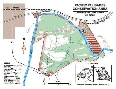
Driving DirectionsThe Jefferson County portion of the area is 1.50 miles south of Pacific on Route F, then 0.10 mile east on English Road. The boat ramp is in St. Louis County; from I-44 take Exit 261 south to Business Loop 44, then west to Dozier Crossing, then south across the railroad tracks, and west on Franklin Road to the access.
HighlightsThis area contains forest, cropland, old fields, a permanent stream (Meramec River) and sand and gravel pits which provide seasonal fishing.
About This AreaPacific Palisades Conservation Area is a 695-acre tract in Jefferson and St. Louis Counties immediately east of Pacific and three miles from Interstate 44.Three miles of lower Meramec River frontage make this a popular spot for anglers to catch bass, crappie, bluegill, and non-game fish.There are two abandoned gravel pits which are connected to the Meramec River during times of high water. The gravel pits are not stocked and are not managed.The area is about 65 percent forested and contains 136 acres of crop fields and grasslands.Birdwatchers may search woodlands, open land or edge for a variety of avian visitors.Squirrels, quail, rabbits, deer, turkey, and furbearers also find food and cover at Pacific Palisades.